
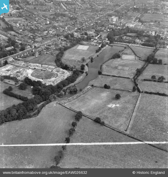
EAW026632 ENGLAND (1949). Walton Dam and environs, Chesterfield, 1949. This image has been produced from a print marked by Aerofilms Ltd for photo editing.
© Copyright OpenStreetMap contributors and licensed by the OpenStreetMap Foundation. 2026. Cartography is licensed as CC BY-SA.
Nearby Images (2)
EAW026632

EAW026631
 and environs, Chesterfield, from the west, 1949. This image has been produced from a damaged negative.")
Details
| Title | [EAW026632] Walton Dam and environs, Chesterfield, 1949. This image has been produced from a print marked by Aerofilms Ltd for photo editing. |
| Reference | EAW026632 |
| Date | 19-September-1949 |
| Link | |
| Place name | CHESTERFIELD |
| Parish | |
| District | |
| Country | ENGLAND |
| Easting / Northing | 436196, 370325 |
| Longitude / Latitude | -1.4577288178763, 53.228450088693 |
| National Grid Reference | SK362703 |
Pins
Be the first to add a comment to this image!
User Comment Contributions
Wow, Walton Dam in 1949. You can see St Thomas Church on the far left |

Peter59 |
Sunday 6th of September 2015 12:38:24 PM |