
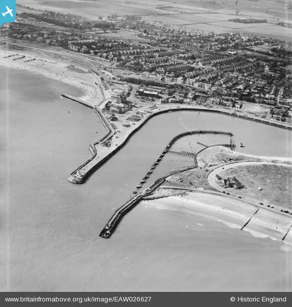
EAW026627 ENGLAND (1949). North Pier, South Pier and the mouth of the River Yare, Great Yarmouth, 1949
© Copyright OpenStreetMap contributors and licensed by the OpenStreetMap Foundation. 2026. Cartography is licensed as CC BY-SA.
Nearby Images (8)
EAW026627

EAW005067

EAW026622

EAW031890

EAW031891

EPW007010

EPW007008

EPW007005

Details
| Title | [EAW026627] North Pier, South Pier and the mouth of the River Yare, Great Yarmouth, 1949 |
| Reference | EAW026627 |
| Date | 16-September-1949 |
| Link | |
| Place name | GREAT YARMOUTH |
| Parish | |
| District | |
| Country | ENGLAND |
| Easting / Northing | 653255, 303719 |
| Longitude / Latitude | 1.7379003620034, 52.571855948613 |
| National Grid Reference | TG533037 |
Pins

redmist |
Wednesday 19th of January 2022 07:17:51 PM | |
|
redmist |
Sunday 16th of January 2022 07:35:12 PM | |
|
redmist |
Sunday 16th of January 2022 07:23:20 PM | |
|
redmist |
Sunday 16th of January 2022 07:19:59 PM | |
|
redmist |
Sunday 16th of January 2022 07:16:52 PM | |
|
redmist |
Sunday 16th of January 2022 07:13:16 PM | |
|
redmist |
Sunday 16th of January 2022 07:10:47 PM | |
|
redmist |
Sunday 16th of January 2022 07:08:07 PM | |

Matt Aldred edob.mattaldred.com |
Sunday 27th of December 2020 04:06:17 PM | |
|
pebble |
Thursday 20th of March 2014 03:51:42 PM |