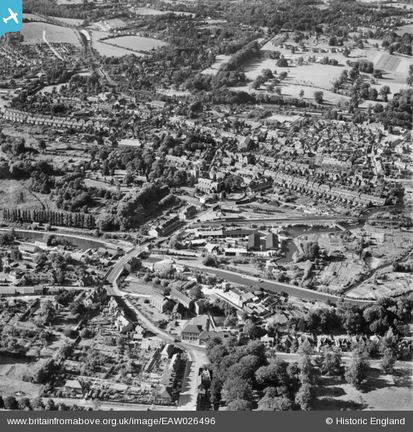
EAW026496 ENGLAND (1949). Church Street and the town, Rickmansworth, 1949
© Copyright OpenStreetMap contributors and licensed by the OpenStreetMap Foundation. 2026. Cartography is licensed as CC BY-SA.
Nearby Images (7)
Details
| Title | [EAW026496] Church Street and the town, Rickmansworth, 1949 |
| Reference | EAW026496 |
| Date | 10-September-1949 |
| Link | |
| Place name | RICKMANSWORTH |
| Parish | |
| District | |
| Country | ENGLAND |
| Easting / Northing | 506158, 194174 |
| Longitude / Latitude | -0.4658717161043, 51.635875334738 |
| National Grid Reference | TQ062942 |
Pins

Bluid |
Thursday 27th of March 2014 06:05:11 PM |


![[EAW026496] Church Street and the town, Rickmansworth, 1949](http://britainfromabove.org.uk/sites/all/libraries/aerofilms-images/public/100x100/EAW/026/EAW026496.jpg)
![[EAW026495] Church Street and the town, Rickmansworth, 1949](http://britainfromabove.org.uk/sites/all/libraries/aerofilms-images/public/100x100/EAW/026/EAW026495.jpg)
![[EPW056339] The town, Rickmansworth, from the south, 1938](http://britainfromabove.org.uk/sites/all/libraries/aerofilms-images/public/100x100/EPW/056/EPW056339.jpg)
![[EAW029476] The town, Rickmansworth, 1950](http://britainfromabove.org.uk/sites/all/libraries/aerofilms-images/public/100x100/EAW/029/EAW029476.jpg)
![[EPW019276] The town and Rickmansworth Park, Rickmansworth, from the south, 1927](http://britainfromabove.org.uk/sites/all/libraries/aerofilms-images/public/100x100/EPW/019/EPW019276.jpg)
![[EPW056338] The railway station, St Mary's Church and the town, Rickmansworth, 1938](http://britainfromabove.org.uk/sites/all/libraries/aerofilms-images/public/100x100/EPW/056/EPW056338.jpg)
![[EPW006200] The Grand Union Canal and River Chess, Batchworth, from the south-west, 1921](http://britainfromabove.org.uk/sites/all/libraries/aerofilms-images/public/100x100/EPW/006/EPW006200.jpg)