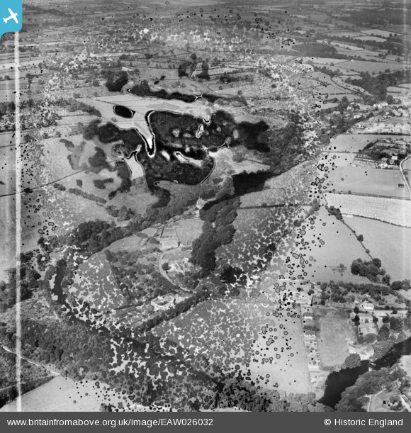
EAW026032 ENGLAND (1949). The Priory (site of) and environs, Knaresborough, 1949. This image has been produced from a damaged negative.
© Copyright OpenStreetMap contributors and licensed by the OpenStreetMap Foundation. 2025. Cartography is licensed as CC BY-SA.
Nearby Images (8)
Details
| Title | [EAW026032] The Priory (site of) and environs, Knaresborough, 1949. This image has been produced from a damaged negative. |
| Reference | EAW026032 |
| Date | 14-August-1949 |
| Link | |
| Place name | KNARESBOROUGH |
| Parish | KNARESBOROUGH |
| District | |
| Country | ENGLAND |
| Easting / Northing | 435593, 455743 |
| Longitude / Latitude | -1.4569993216643, 53.996304353118 |
| National Grid Reference | SE356557 |
Pins
Be the first to add a comment to this image!


![[EAW026032] The Priory (site of) and environs, Knaresborough, 1949. This image has been produced from a damaged negative.](http://britainfromabove.org.uk/sites/all/libraries/aerofilms-images/public/100x100/EAW/026/EAW026032.jpg)
![[EAW026031] Abbey Road, The Priory and environs, Knaresborough, 1949. This image has been produced from a print marked by Aerofilms Ltd for photo editing.](http://britainfromabove.org.uk/sites/all/libraries/aerofilms-images/public/100x100/EAW/026/EAW026031.jpg)
![[EAW026024] Abbey Road, The Priory and environs, Knaresborough, 1949. This image has been produced from a damaged negative.](http://britainfromabove.org.uk/sites/all/libraries/aerofilms-images/public/100x100/EAW/026/EAW026024.jpg)
![[EAW026026] Abbey Road, The Priory and environs, Knaresborough, 1949. This image has been produced from a print.](http://britainfromabove.org.uk/sites/all/libraries/aerofilms-images/public/100x100/EAW/026/EAW026026.jpg)
![[EAW026025] Abbey Road, The Priory and environs, Knaresborough, from the south-east, 1949. This image has been produced from a print marked by Aerofilms Ltd for photo editing.](http://britainfromabove.org.uk/sites/all/libraries/aerofilms-images/public/100x100/EAW/026/EAW026025.jpg)
![[EAW026030] Abbey Road, The Priory and environs, Knaresborough, 1949. This image has been produced from a print.](http://britainfromabove.org.uk/sites/all/libraries/aerofilms-images/public/100x100/EAW/026/EAW026030.jpg)
![[EAW026027] Abbey Farm, Knaresborough, from the south, 1949. This image has been produced from a print marked by Aerofilms Ltd for photo editing.](http://britainfromabove.org.uk/sites/all/libraries/aerofilms-images/public/100x100/EAW/026/EAW026027.jpg)
![[EAW026028] Abbey Road, The Priory and environs, Knaresborough, from the south-west, 1949. This image has been produced from a print marked by Aerofilms Ltd for photo editing.](http://britainfromabove.org.uk/sites/all/libraries/aerofilms-images/public/100x100/EAW/026/EAW026028.jpg)