
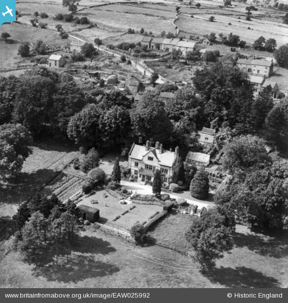
EAW025992 ENGLAND (1949). Slaley Hall, Slaley, 1949. This image has been produced from a print.
© Copyright OpenStreetMap contributors and licensed by the OpenStreetMap Foundation. 2025. Cartography is licensed as CC BY-SA.
Nearby Images (3)
EAW025992

EAW025990

EAW025991

Details
| Title | [EAW025992] Slaley Hall, Slaley, 1949. This image has been produced from a print. |
| Reference | EAW025992 |
| Date | 13-August-1949 |
| Link | |
| Place name | SLALEY |
| Parish | BONSALL |
| District | |
| Country | ENGLAND |
| Easting / Northing | 427340, 357406 |
| Longitude / Latitude | -1.5915053772476, 53.112841512572 |
| National Grid Reference | SK273574 |
Pins
Be the first to add a comment to this image!