
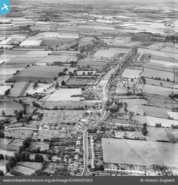
EAW025903 ENGLAND (1949). The Green and the town, Dovercourt, from the north-east, 1949
© Copyright OpenStreetMap contributors and licensed by the OpenStreetMap Foundation. 2026. Cartography is licensed as CC BY-SA.
Nearby Images (2)
EAW025903

EAW025904

Details
| Title | [EAW025903] The Green and the town, Dovercourt, from the north-east, 1949 |
| Reference | EAW025903 |
| Date | 10-August-1949 |
| Link | |
| Place name | DOVERCOURT |
| Parish | HARWICH |
| District | |
| Country | ENGLAND |
| Easting / Northing | 624046, 231107 |
| Longitude / Latitude | 1.2594331480451, 51.932864444909 |
| National Grid Reference | TM240311 |
Pins

Matt Aldred edob.mattaldred.com |
Friday 22nd of August 2025 01:23:52 PM | |
|
Matt Aldred edob.mattaldred.com |
Friday 22nd of August 2025 01:23:37 PM | |

The Laird |
Friday 2nd of December 2016 10:36:24 PM | |
|
cptpies |
Tuesday 14th of January 2014 09:42:34 AM | |
|
cptpies |
Tuesday 14th of January 2014 09:40:58 AM | |
|
cptpies |
Tuesday 14th of January 2014 09:40:00 AM | |
|
cptpies |
Tuesday 14th of January 2014 09:39:21 AM |
User Comment Contributions

Stanier Line obstacles and pillboxes. |
cptpies |
Tuesday 14th of January 2014 09:43:01 AM |