
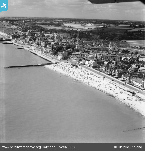
EAW025887 ENGLAND (1949). Prince's Esplanade and the town, Walton-On-The-Naze, from the east, 1949
© Copyright OpenStreetMap contributors and licensed by the OpenStreetMap Foundation. 2026. Cartography is licensed as CC BY-SA.
Nearby Images (3)
EAW025887

EAW025888

EAW025886

Details
| Title | [EAW025887] Prince's Esplanade and the town, Walton-On-The-Naze, from the east, 1949 |
| Reference | EAW025887 |
| Date | 10-August-1949 |
| Link | |
| Place name | WALTON-ON-THE-NAZE |
| Parish | FRINTON AND WALTON |
| District | |
| Country | ENGLAND |
| Easting / Northing | 625800, 221952 |
| Longitude / Latitude | 1.2789121307464, 51.849969934915 |
| National Grid Reference | TM258220 |
Pins

Stephen Mirrington |
Wednesday 8th of October 2025 05:36:14 PM |