
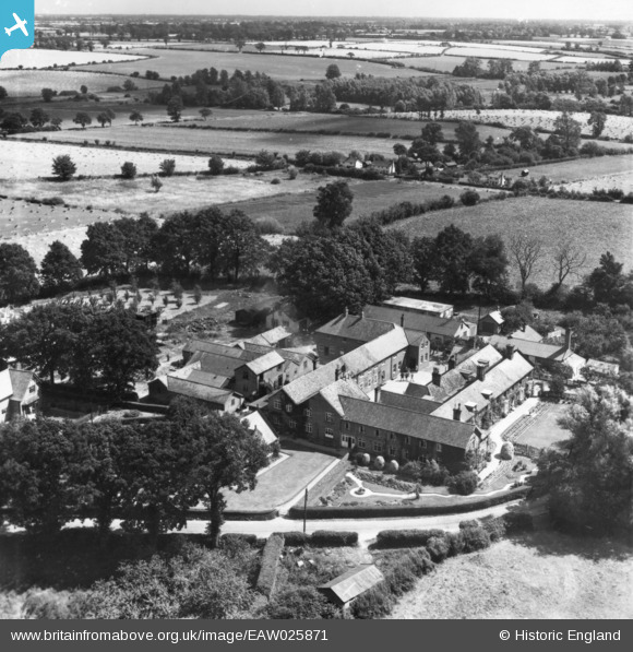
EAW025871 ENGLAND (1949). Kerrison School, Thorndon, from the north-west, 1949. This image has been produced from a print.
© Copyright OpenStreetMap contributors and licensed by the OpenStreetMap Foundation. 2026. Cartography is licensed as CC BY-SA.
Nearby Images (4)
EAW025871

EAW025870

EAW025868

EAW025869

Details
| Title | [EAW025871] Kerrison School, Thorndon, from the north-west, 1949. This image has been produced from a print. |
| Reference | EAW025871 |
| Date | 10-August-1949 |
| Link | |
| Place name | THORNDON |
| Parish | THORNDON |
| District | |
| Country | ENGLAND |
| Easting / Northing | 613201, 270288 |
| Longitude / Latitude | 1.1264502369049, 52.288902216988 |
| National Grid Reference | TM132703 |
Pins
Be the first to add a comment to this image!
User Comment Contributions

"Stand at ease" and stare, A group of boys also seen in EAW025868 |

clippedwings |
Monday 24th of August 2015 09:38:13 PM |