
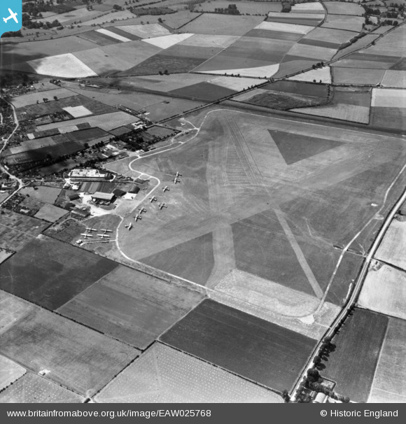
EAW025768 ENGLAND (1949). Aylesbury and Thame Airport (Haddenham Airfield), Haddenham, 1949. This image has been produced from a print.
© Copyright OpenStreetMap contributors and licensed by the OpenStreetMap Foundation. 2026. Cartography is licensed as CC BY-SA.
Nearby Images (6)
EAW025768
, Haddenham, 1949. This image has been produced from a print.")
EAW025770
, Haddenham, 1949. This image has been produced from a print.")
EAW025769
, Haddenham, 1949. This image has been produced from a print.")
EAW025763
, Haddenham, 1949. This image has been produced from a print.")
EAW025767
, Haddenham, 1949. This image has been produced from a print.")
EAW025764
, Haddenham, 1949. This image has been produced from a print.")
Details
| Title | [EAW025768] Aylesbury and Thame Airport (Haddenham Airfield), Haddenham, 1949. This image has been produced from a print. |
| Reference | EAW025768 |
| Date | 8-August-1949 |
| Link | |
| Place name | HADDENHAM |
| Parish | HADDENHAM |
| District | |
| Country | ENGLAND |
| Easting / Northing | 473431, 209164 |
| Longitude / Latitude | -0.93555596943819, 51.775871054817 |
| National Grid Reference | SP734092 |
Pins

Matt Aldred edob.mattaldred.com |
Thursday 1st of April 2021 04:58:42 PM |