
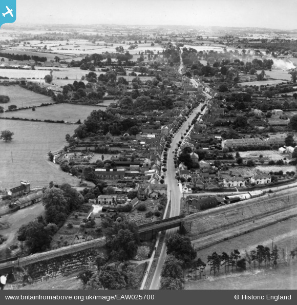
EAW025700 ENGLAND (1949). The High Street, Henley-in-Arden, from the north, 1949. This image has been produced from a print.
© Copyright OpenStreetMap contributors and licensed by the OpenStreetMap Foundation. 2026. Cartography is licensed as CC BY-SA.
Nearby Images (3)
EAW025700

EPW034334

EAW025699

Details
| Title | [EAW025700] The High Street, Henley-in-Arden, from the north, 1949. This image has been produced from a print. |
| Reference | EAW025700 |
| Date | 4-August-1949 |
| Link | |
| Place name | HENLEY-IN-ARDEN |
| Parish | HENLEY-IN-ARDEN |
| District | |
| Country | ENGLAND |
| Easting / Northing | 415243, 266580 |
| Longitude / Latitude | -1.776459838, 52.296744607767 |
| National Grid Reference | SP152666 |
Pins
Be the first to add a comment to this image!