
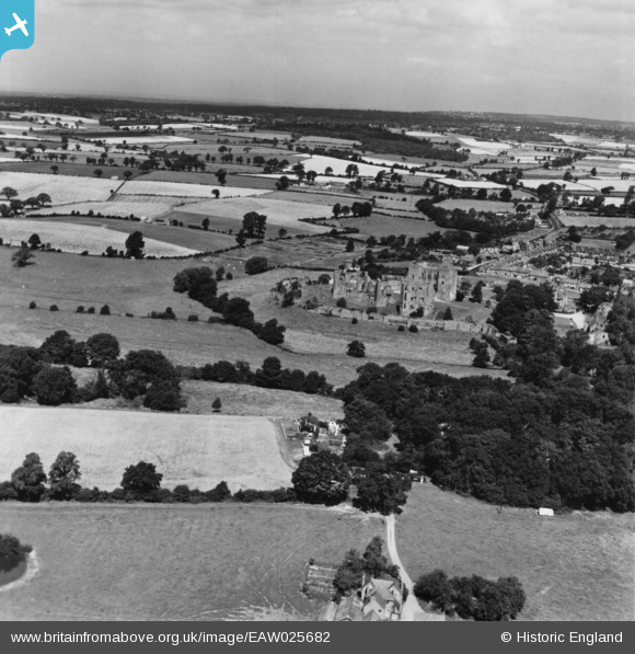
EAW025682 ENGLAND (1949). Kenilworth Castle and environs, Kenilworth, from the south-east, 1949. This image has been produced from a print.
© Copyright OpenStreetMap contributors and licensed by the OpenStreetMap Foundation. 2026. Cartography is licensed as CC BY-SA.
Nearby Images (5)
EAW025682

EAW025680

EAW025678

EAW006691

EAW025679

Details
| Title | [EAW025682] Kenilworth Castle and environs, Kenilworth, from the south-east, 1949. This image has been produced from a print. |
| Reference | EAW025682 |
| Date | 4-August-1949 |
| Link | |
| Place name | KENILWORTH |
| Parish | KENILWORTH |
| District | |
| Country | ENGLAND |
| Easting / Northing | 427910, 271923 |
| Longitude / Latitude | -1.5902574815724, 52.344285996693 |
| National Grid Reference | SP279719 |
Pins
Be the first to add a comment to this image!