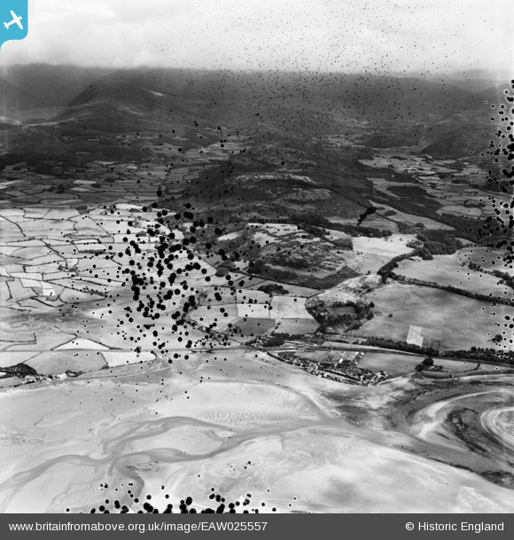
EAW025557 ENGLAND (1949). The town looking towards Muncaster Fell, Ravenglass, from the south-west, 1949. This image has been produced from a damaged negative.
© Copyright OpenStreetMap contributors and licensed by the OpenStreetMap Foundation. 2026. Cartography is licensed as CC BY-SA.
Details
| Title | [EAW025557] The town looking towards Muncaster Fell, Ravenglass, from the south-west, 1949. This image has been produced from a damaged negative. |
| Reference | EAW025557 |
| Date | 3-August-1949 |
| Link | |
| Place name | RAVENGLASS |
| Parish | MUNCASTER |
| District | |
| Country | ENGLAND |
| Easting / Northing | 308476, 496567 |
| Longitude / Latitude | -3.4084902506137, 54.356257119139 |
| National Grid Reference | SD085966 |


![[EAW025557] The town looking towards Muncaster Fell, Ravenglass, from the south-west, 1949. This image has been produced from a damaged negative.](http://britainfromabove.org.uk/sites/all/libraries/aerofilms-images/public/100x100/EAW/025/EAW025557.jpg)
![[EAW025558] The mouth of the River Mite looking towards Wast Water, Ravenglass, from the south-west, 1949. This image has been produced from a damaged negative.](http://britainfromabove.org.uk/sites/all/libraries/aerofilms-images/public/100x100/EAW/025/EAW025558.jpg)
