
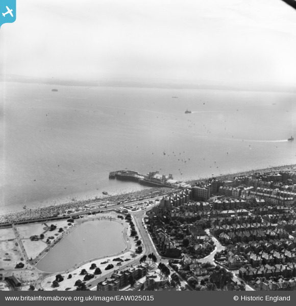
EAW025015 ENGLAND (1949). South Parade Pier, the seafront and the Solent, Southsea, from the north-east, 1949. This image has been produced from a print.
© Copyright OpenStreetMap contributors and licensed by the OpenStreetMap Foundation. 2026. Cartography is licensed as CC BY-SA.
Nearby Images (11)
EAW025015

EPW024696

EAW003011

EAW003008

EAW003010

EAW025014

EPW024689

EPW024697

EPW024692

EPW039676

EPW024690

Details
| Title | [EAW025015] South Parade Pier, the seafront and the Solent, Southsea, from the north-east, 1949. This image has been produced from a print. |
| Reference | EAW025015 |
| Date | 23-July-1949 |
| Link | |
| Place name | SOUTHSEA |
| Parish | SOUTHSEA |
| District | |
| Country | ENGLAND |
| Easting / Northing | 465365, 98267 |
| Longitude / Latitude | -1.0727573525404, 50.779725112222 |
| National Grid Reference | SZ654983 |
Pins
Be the first to add a comment to this image!