
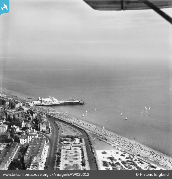
EAW025012 ENGLAND (1949). South Parade Pier, the seafront and environs, Southsea, from the north-west, 1949. This image has been produced from a print.
© Copyright OpenStreetMap contributors and licensed by the OpenStreetMap Foundation. 2026. Cartography is licensed as CC BY-SA.
Nearby Images (11)
EAW025012

EAW025010

EPW024693

EAW025018

EAW025009

EPW024690

EAW025007

EPW039677

EAW003009

EPW024692

EPW024691

Details
| Title | [EAW025012] South Parade Pier, the seafront and environs, Southsea, from the north-west, 1949. This image has been produced from a print. |
| Reference | EAW025012 |
| Date | 23-July-1949 |
| Link | |
| Place name | SOUTHSEA |
| Parish | SOUTHSEA |
| District | |
| Country | ENGLAND |
| Easting / Northing | 464960, 98032 |
| Longitude / Latitude | -1.0785432626961, 50.777657409416 |
| National Grid Reference | SZ650980 |
Pins
 |

Billy Turner |
Tuesday 22nd of December 2015 03:33:59 PM |