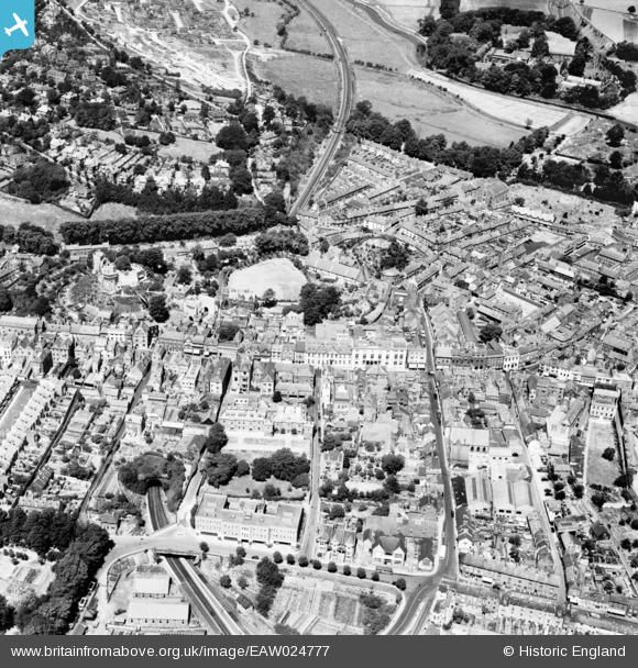
EAW024777 ENGLAND (1949). The town centre, Lewes, 1949
© Copyright OpenStreetMap contributors and licensed by the OpenStreetMap Foundation. 2026. Cartography is licensed as CC BY-SA.
Nearby Images (6)
Details
| Title | [EAW024777] The town centre, Lewes, 1949 |
| Reference | EAW024777 |
| Date | 12-July-1949 |
| Link | |
| Place name | LEWES |
| Parish | LEWES |
| District | |
| Country | ENGLAND |
| Easting / Northing | 541486, 110111 |
| Longitude / Latitude | 0.011118149690985, 50.872602805548 |
| National Grid Reference | TQ415101 |
Pins

Bart |
Thursday 22nd of February 2024 12:37:41 PM | |

Alan McFaden |
Tuesday 22nd of July 2014 08:25:34 AM | |

Alan McFaden |
Tuesday 22nd of July 2014 08:22:16 AM | |

Alan McFaden |
Tuesday 22nd of July 2014 08:21:11 AM | |

Alan McFaden |
Tuesday 22nd of July 2014 08:17:41 AM | |

Alan McFaden |
Tuesday 22nd of July 2014 08:16:33 AM | |

Paul F |
Monday 28th of April 2014 04:17:42 PM | |

Paul F |
Monday 28th of April 2014 04:16:59 PM | |

Paul F |
Monday 28th of April 2014 04:16:07 PM | |

Paul F |
Monday 28th of April 2014 04:15:32 PM | |

Paul F |
Monday 28th of April 2014 04:14:53 PM | |

Brightonboy |
Saturday 28th of December 2013 09:09:45 PM | |

Brightonboy |
Saturday 28th of December 2013 09:08:50 PM | |

Brightonboy |
Saturday 28th of December 2013 09:08:22 PM |


![[EAW024777] The town centre, Lewes, 1949](http://britainfromabove.org.uk/sites/all/libraries/aerofilms-images/public/100x100/EAW/024/EAW024777.jpg)
![[EPW011516] Lewes Castle and environs, Lewes, 1924](http://britainfromabove.org.uk/sites/all/libraries/aerofilms-images/public/100x100/EPW/011/EPW011516.jpg)
![[EAW024776] The town, Lewes, 1949](http://britainfromabove.org.uk/sites/all/libraries/aerofilms-images/public/100x100/EAW/024/EAW024776.jpg)
![[EPW045579] St Swithun's Terrace, Lewes Castle and the town, Lewes, 1934. This image has been produced from a copy-negative.](http://britainfromabove.org.uk/sites/all/libraries/aerofilms-images/public/100x100/EPW/045/EPW045579.jpg)
![[EAW024774] The town, Lewes, 1949](http://britainfromabove.org.uk/sites/all/libraries/aerofilms-images/public/100x100/EAW/024/EAW024774.jpg)
![[EPW011511] Lewes Castle and the High Street, Lewes, 1924. This image has been produced from a copy-negative affected by flare.](http://britainfromabove.org.uk/sites/all/libraries/aerofilms-images/public/100x100/EPW/011/EPW011511.jpg)


