
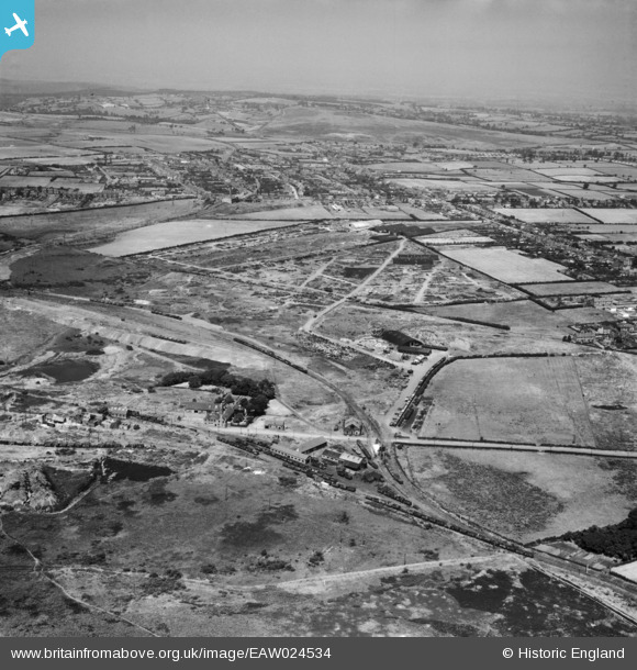
EAW024534 ENGLAND (1949). The site of the Cannock Chase Collieries, Chasetown, from the south, 1949
© Copyright OpenStreetMap contributors and licensed by the OpenStreetMap Foundation. 2026. Cartography is licensed as CC BY-SA.
Nearby Images (2)
EAW024534

EAW024542

Details
| Title | [EAW024534] The site of the Cannock Chase Collieries, Chasetown, from the south, 1949 |
| Reference | EAW024534 |
| Date | 8-July-1949 |
| Link | |
| Place name | CHASETOWN |
| Parish | BURNTWOOD |
| District | |
| Country | ENGLAND |
| Easting / Northing | 403916, 308134 |
| Longitude / Latitude | -1.9420826319945, 52.670554086976 |
| National Grid Reference | SK039081 |
Pins

Bob |
Wednesday 20th of October 2021 12:09:18 PM | |
|
areed |
Monday 4th of January 2021 04:04:23 PM | |
|
areed |
Monday 4th of January 2021 03:58:30 PM | |
|
areed |
Monday 4th of January 2021 03:56:42 PM | |
|
areed |
Thursday 23rd of April 2020 08:54:41 PM | |
|
areed |
Thursday 23rd of April 2020 08:54:03 PM | |
|
areed |
Thursday 23rd of April 2020 08:52:54 PM | |
|
areed |
Thursday 23rd of April 2020 08:52:14 PM | |
|
KevTheBusDriver |
Friday 1st of January 2016 08:55:17 PM | |
|
KevTheBusDriver |
Friday 1st of January 2016 08:52:21 PM | |

Class31 |
Wednesday 15th of October 2014 04:48:08 PM | |
|
Martin |
Wednesday 25th of December 2013 08:14:54 PM |
