
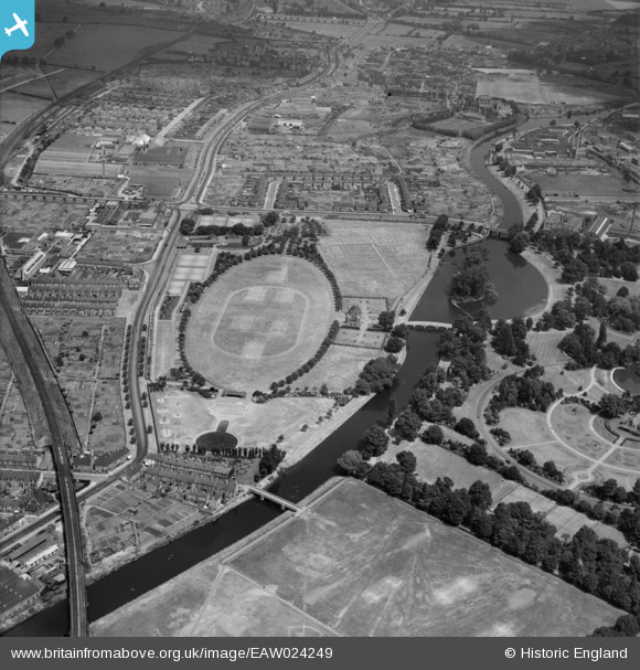
EAW024249 ENGLAND (1949). The Abbey Grounds (The Oval) and the site of Leicester Abbey, Leicester, 1949
© Copyright OpenStreetMap contributors and licensed by the OpenStreetMap Foundation. 2026. Cartography is licensed as CC BY-SA.
Nearby Images (6)
EAW024249
 and the site of Leicester Abbey, Leicester, 1949")
EAW024250
 and the site of Leicester Abbey, Leicester, 1949")
EAW024251
 and the site of Leicester Abbey, Leicester, 1949")
EAW043361

EPW055013

EAW024248

Details
| Title | [EAW024249] The Abbey Grounds (The Oval) and the site of Leicester Abbey, Leicester, 1949 |
| Reference | EAW024249 |
| Date | 27-June-1949 |
| Link | |
| Place name | LEICESTER |
| Parish | |
| District | |
| Country | ENGLAND |
| Easting / Northing | 458399, 305839 |
| Longitude / Latitude | -1.1367425601144, 52.646790221172 |
| National Grid Reference | SK584058 |
