
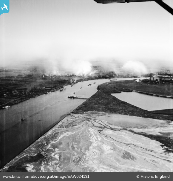
EAW024131 ENGLAND (1949). The River Tees with Middlesbrough in the distance, Port Clarence, from the north, 1949
© Copyright OpenStreetMap contributors and licensed by the OpenStreetMap Foundation. 2026. Cartography is licensed as CC BY-SA.
Nearby Images (2)
EAW024131

EPW038891

Details
| Title | [EAW024131] The River Tees with Middlesbrough in the distance, Port Clarence, from the north, 1949 |
| Reference | EAW024131 |
| Date | 22-June-1949 |
| Link | |
| Place name | PORT CLARENCE |
| Parish | BILLINGHAM |
| District | |
| Country | ENGLAND |
| Easting / Northing | 452959, 522977 |
| Longitude / Latitude | -1.1801737291682, 54.599071732025 |
| National Grid Reference | NZ530230 |
Pins
Be the first to add a comment to this image!