
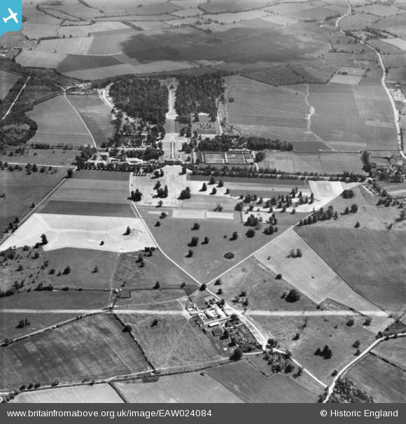
EAW024084 ENGLAND (1949). Home Farm and Wrest Park, Silsoe, 1949. This image has been produced from a print marked by Aerofilms Ltd for photo editing.
© Copyright OpenStreetMap contributors and licensed by the OpenStreetMap Foundation. 2025. Cartography is licensed as CC BY-SA.
Nearby Images (2)
EAW024084

EAW049228

Details
| Title | [EAW024084] Home Farm and Wrest Park, Silsoe, 1949. This image has been produced from a print marked by Aerofilms Ltd for photo editing. |
| Reference | EAW024084 |
| Date | 20-June-1949 |
| Link | |
| Place name | SILSOE |
| Parish | SILSOE |
| District | |
| Country | ENGLAND |
| Easting / Northing | 508951, 235795 |
| Longitude / Latitude | -0.41242629770075, 52.009455124752 |
| National Grid Reference | TL090358 |
Pins

brian |
Tuesday 2nd of September 2014 01:07:33 AM | |
|
brian |
Tuesday 2nd of September 2014 01:06:58 AM | |
|
brian |
Tuesday 2nd of September 2014 01:06:17 AM | |
|
brian |
Tuesday 2nd of September 2014 01:04:34 AM | |
|
brian |
Tuesday 2nd of September 2014 01:03:49 AM | |
|
brian |
Tuesday 2nd of September 2014 01:03:05 AM | |
|
brian |
Tuesday 2nd of September 2014 01:02:41 AM | |
|
brian |
Tuesday 2nd of September 2014 01:01:41 AM | |
|
brian |
Tuesday 2nd of September 2014 12:59:41 AM |