
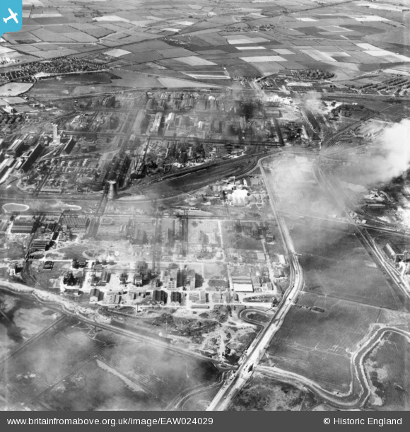
EAW024029 ENGLAND (1949). The ICI Synthetic Ammonia Works, Billingham, 1949. This image has been produced from a print.
© Copyright OpenStreetMap contributors and licensed by the OpenStreetMap Foundation. 2026. Cartography is licensed as CC BY-SA.
Nearby Images (24)
EAW024029

EAW043764

EPW049202

EAW043762

EAW043767

EPW049204

EPW049205

EPW049201

EPW049207

EPW049206

EPW032712

EAW043758

EPW049203

EPW032192

EAW043763

EAW024047

EPW032193

EAW043765

EPW032209

EPW032182

EAW024028

EAW043759

EAW043761

EAW043766

Details
| Title | [EAW024029] The ICI Synthetic Ammonia Works, Billingham, 1949. This image has been produced from a print. |
| Reference | EAW024029 |
| Date | 21-June-1949 |
| Link | |
| Place name | BILLINGHAM |
| Parish | BILLINGHAM |
| District | |
| Country | ENGLAND |
| Easting / Northing | 447154, 521553 |
| Longitude / Latitude | -1.2702576636654, 54.586849269582 |
| National Grid Reference | NZ472216 |
Pins
Be the first to add a comment to this image!