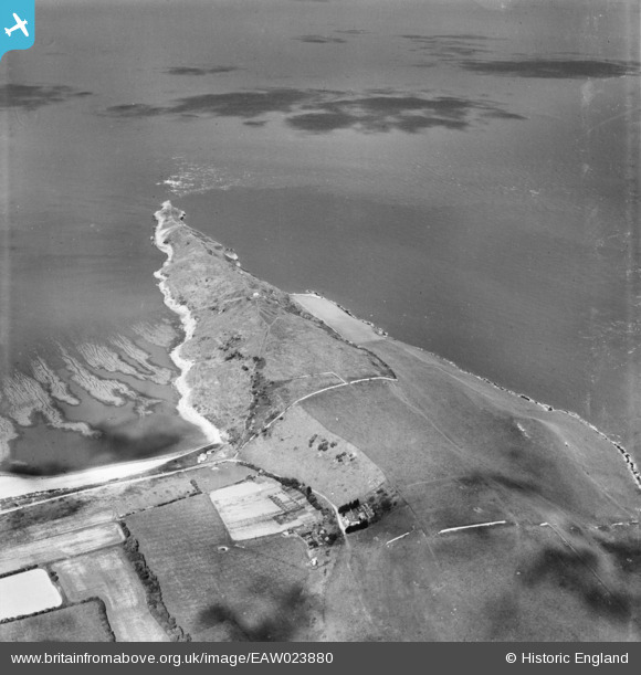
EAW023880 ENGLAND (1949). Middle Hope, Kewstoke, 1949
© Copyright OpenStreetMap contributors and licensed by the OpenStreetMap Foundation. 2026. Cartography is licensed as CC BY-SA.
Details
| Title | [EAW023880] Middle Hope, Kewstoke, 1949 |
| Reference | EAW023880 |
| Date | 14-June-1949 |
| Link | |
| Place name | KEWSTOKE |
| Parish | KEWSTOKE |
| District | |
| Country | ENGLAND |
| Easting / Northing | 332645, 166104 |
| Longitude / Latitude | -2.9681185329007, 51.389479373365 |
| National Grid Reference | ST326661 |
Pins

Matt Aldred edob.mattaldred.com |
Monday 21st of March 2022 01:48:38 PM |


![[EAW023880] Middle Hope, Kewstoke, 1949](http://britainfromabove.org.uk/sites/all/libraries/aerofilms-images/public/100x100/EAW/023/EAW023880.jpg)
![[EAW023881] Middle Hope, Kewstoke, 1949](http://britainfromabove.org.uk/sites/all/libraries/aerofilms-images/public/100x100/EAW/023/EAW023881.jpg)