
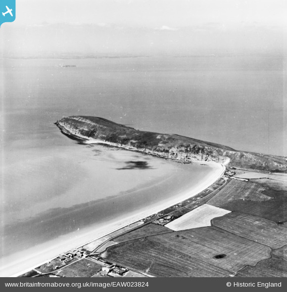
EAW023824 ENGLAND (1949). Brean Down, Brean, from the south-east, 1949. This image has been produced from a print.
© Copyright OpenStreetMap contributors and licensed by the OpenStreetMap Foundation. 2026. Cartography is licensed as CC BY-SA.
Details
| Title | [EAW023824] Brean Down, Brean, from the south-east, 1949. This image has been produced from a print. |
| Reference | EAW023824 |
| Date | 14-June-1949 |
| Link | |
| Place name | BREAN |
| Parish | BREAN |
| District | |
| Country | ENGLAND |
| Easting / Northing | 329600, 157947 |
| Longitude / Latitude | -3.0102638343256, 51.315767381473 |
| National Grid Reference | ST296579 |
Pins

Matt Aldred edob.mattaldred.com |
Monday 21st of March 2022 02:03:23 PM | |

jrussill |
Wednesday 12th of November 2014 06:13:45 PM |
User Comment Contributions

WW2 Bomber Guidance Arrow |
jrussill |
Wednesday 12th of November 2014 06:14:14 PM |