
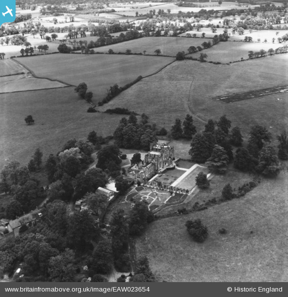
EAW023654 ENGLAND (1949). Hilfield Castle, Bushey, 1949. This image has been produced from a print.
© Copyright OpenStreetMap contributors and licensed by the OpenStreetMap Foundation. 2026. Cartography is licensed as CC BY-SA.
Nearby Images (8)
EAW023654

EAW023649

EAW048862

EAW023651

EAW023650

EAW023653

EAW023652

EAW045346

Details
| Title | [EAW023654] Hilfield Castle, Bushey, 1949. This image has been produced from a print. |
| Reference | EAW023654 |
| Date | 2-June-1949 |
| Link | |
| Place name | BUSHEY |
| Parish | |
| District | |
| Country | ENGLAND |
| Easting / Northing | 515283, 196329 |
| Longitude / Latitude | -0.33335042643502, 51.653449079067 |
| National Grid Reference | TQ153963 |
Pins
Be the first to add a comment to this image!