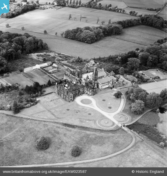
EAW023587 ENGLAND (1949). Scarisbrick Hall, Scarisbrick, 1949
© Copyright OpenStreetMap contributors and licensed by the OpenStreetMap Foundation. 2025. Cartography is licensed as CC BY-SA.
Nearby Images (2)
EAW023587

EAW023588

Details
| Title | [EAW023587] Scarisbrick Hall, Scarisbrick, 1949 |
| Reference | EAW023587 |
| Date | 29-May-1949 |
| Link | |
| Place name | SCARISBRICK |
| Parish | SCARISBRICK |
| District | |
| Country | ENGLAND |
| Easting / Northing | 339190, 412605 |
| Longitude / Latitude | -2.9191442722732, 53.606233563232 |
| National Grid Reference | SD392126 |
Pins
 Class31 |
Sunday 1st of May 2016 11:50:57 AM |