
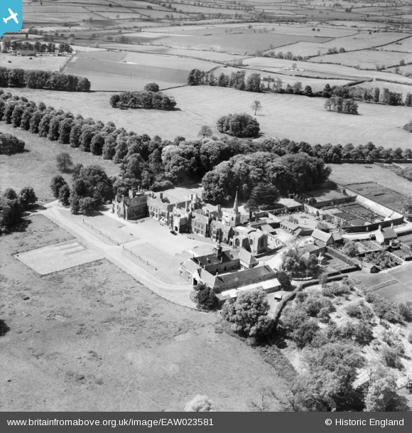
EAW023581 ENGLAND (1949). Nevill Holt School, Nevill Holt, 1949
© Copyright OpenStreetMap contributors and licensed by the OpenStreetMap Foundation. 2025. Cartography is licensed as CC BY-SA.
Nearby Images (3)
EAW023581

EAW023580

EAW023579

Details
| Title | [EAW023581] Nevill Holt School, Nevill Holt, 1949 |
| Reference | EAW023581 |
| Date | 25-May-1949 |
| Link | |
| Place name | NEVILL HOLT |
| Parish | NEVILL HOLT |
| District | |
| Country | ENGLAND |
| Easting / Northing | 481592, 293690 |
| Longitude / Latitude | -0.79696786713086, 52.534591638595 |
| National Grid Reference | SP816937 |
Pins
Be the first to add a comment to this image!