
Downtime message
Due to planned maintenance taking place on Thursday 9th October between 9:00 AM and 1:00 PM, services might be disrupted or temporarily unavailable. We apologise for any inconvenience.
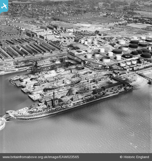
EAW023565 ENGLAND (1949). Herculaneum Graving Docks, Liverpool, 1949
© Copyright OpenStreetMap contributors and licensed by the OpenStreetMap Foundation. 2025. Cartography is licensed as CC BY-SA.
Nearby Images (3)
EAW023565

EPW018910

EPW051313

Details
| Title | [EAW023565] Herculaneum Graving Docks, Liverpool, 1949 |
| Reference | EAW023565 |
| Date | 28-May-1949 |
| Link | |
| Place name | LIVERPOOL |
| Parish | |
| District | |
| Country | ENGLAND |
| Easting / Northing | 335659, 387150 |
| Longitude / Latitude | -2.9672866582668, 53.377017539793 |
| National Grid Reference | SJ357872 |
