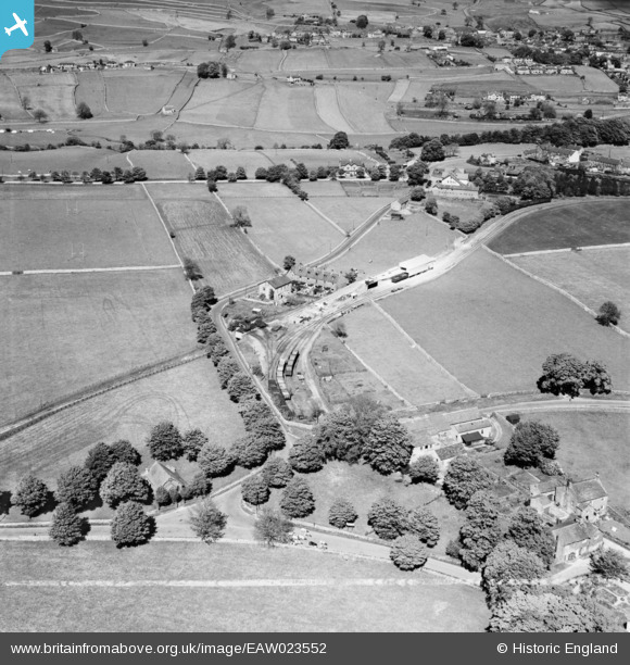
EAW023552 ENGLAND (1949). Woodland View, Woodland Terrace and environs, Threshfield, 1949. This image was marked by Aerofilms Ltd for photo editing.
© Copyright OpenStreetMap contributors and licensed by the OpenStreetMap Foundation. 2026. Cartography is licensed as CC BY-SA.
Details
| Title | [EAW023552] Woodland View, Woodland Terrace and environs, Threshfield, 1949. This image was marked by Aerofilms Ltd for photo editing. |
| Reference | EAW023552 |
| Date | 28-May-1949 |
| Link | |
| Place name | THRESHFIELD |
| Parish | THRESHFIELD |
| District | |
| Country | ENGLAND |
| Easting / Northing | 399122, 463786 |
| Longitude / Latitude | -2.0134182068765, 54.069825849836 |
| National Grid Reference | SD991638 |


![[EAW023552] Woodland View, Woodland Terrace and environs, Threshfield, 1949. This image was marked by Aerofilms Ltd for photo editing.](http://britainfromabove.org.uk/sites/all/libraries/aerofilms-images/public/100x100/EAW/023/EAW023552.jpg)
![[EAW023553] Grassington & Threshfield Railway Station looking towards Threshfield Limestone Quarries and beyond, Threshfield, from the east, 1949. This image was marked by Aerofilms Ltd for photo editing.](http://britainfromabove.org.uk/sites/all/libraries/aerofilms-images/public/100x100/EAW/023/EAW023553.jpg)
