
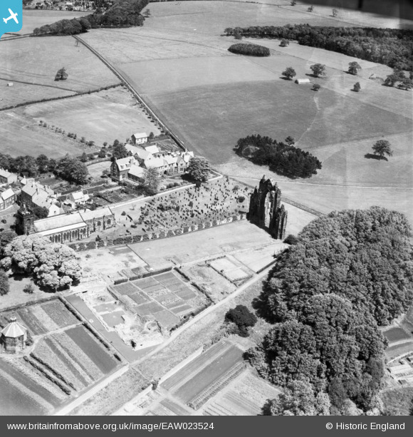
EAW023524 ENGLAND (1949). Guisborough Priory, St Nicholas' Church and the Grammar School, Guisborough, 1949
© Copyright OpenStreetMap contributors and licensed by the OpenStreetMap Foundation. 2026. Cartography is licensed as CC BY-SA.
Nearby Images (8)
EAW023524

EAW023523

EAW023517

EPW038955

EAW023516

EAW023518

EPW038958

EPW038956

Details
| Title | [EAW023524] Guisborough Priory, St Nicholas' Church and the Grammar School, Guisborough, 1949 |
| Reference | EAW023524 |
| Date | 28-May-1949 |
| Link | |
| Place name | GUISBOROUGH |
| Parish | GUISBOROUGH |
| District | |
| Country | ENGLAND |
| Easting / Northing | 461732, 516119 |
| Longitude / Latitude | -1.0458241507082, 54.536445775091 |
| National Grid Reference | NZ617161 |
Pins

redmist |
Saturday 27th of November 2021 11:16:18 PM |