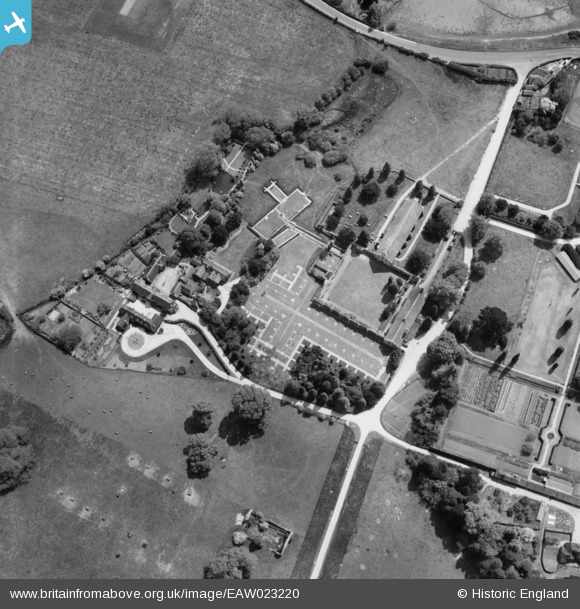
EAW023220 ENGLAND (1949). Beaulieu Abbey, Beaulieu, 1949
© Copyright OpenStreetMap contributors and licensed by the OpenStreetMap Foundation. 2025. Cartography is licensed as CC BY-SA.
Nearby Images (12)
Details
| Title | [EAW023220] Beaulieu Abbey, Beaulieu, 1949 |
| Reference | EAW023220 |
| Date | 19-May-1949 |
| Link | |
| Place name | BEAULIEU |
| Parish | BEAULIEU |
| District | |
| Country | ENGLAND |
| Easting / Northing | 438863, 102618 |
| Longitude / Latitude | -1.4482189231801, 50.821236928897 |
| National Grid Reference | SU389026 |
Pins
Be the first to add a comment to this image!


![[EAW023220] Beaulieu Abbey, Beaulieu, 1949](http://britainfromabove.org.uk/sites/all/libraries/aerofilms-images/public/100x100/EAW/023/EAW023220.jpg)
![[EAW023217] Beaulieu Abbey, Beaulieu, 1949](http://britainfromabove.org.uk/sites/all/libraries/aerofilms-images/public/100x100/EAW/023/EAW023217.jpg)
![[EAW023218] Beaulieu Abbey, Beaulieu, 1949](http://britainfromabove.org.uk/sites/all/libraries/aerofilms-images/public/100x100/EAW/023/EAW023218.jpg)
![[EPW032279] The Abbey Church Cloisters, the ruins of Beaulieu Abbey and St Mary's Church, Beaulieu, 1930](http://britainfromabove.org.uk/sites/all/libraries/aerofilms-images/public/100x100/EPW/032/EPW032279.jpg)
![[EPW032277] The ruins of Beaulieu Abbey, St Mary's Church and the Winepress, Beaulieu, 1930](http://britainfromabove.org.uk/sites/all/libraries/aerofilms-images/public/100x100/EPW/032/EPW032277.jpg)
![[EAW023215] Beaulieu Abbey, Beaulieu, 1949](http://britainfromabove.org.uk/sites/all/libraries/aerofilms-images/public/100x100/EAW/023/EAW023215.jpg)
![[EAW023219] Beaulieu Abbey, Beaulieu, 1949](http://britainfromabove.org.uk/sites/all/libraries/aerofilms-images/public/100x100/EAW/023/EAW023219.jpg)
![[EAW023216] Beaulieu Abbey, Beaulieu, 1949](http://britainfromabove.org.uk/sites/all/libraries/aerofilms-images/public/100x100/EAW/023/EAW023216.jpg)
![[EPW037451] Beaulieu Abbey, Beaulieu, 1932](http://britainfromabove.org.uk/sites/all/libraries/aerofilms-images/public/100x100/EPW/037/EPW037451.jpg)
![[EPW032278] Palace House, the ruins of Beaulieu Abbey and Great Goswell Copse, Beaulieu, from the south, 1930](http://britainfromabove.org.uk/sites/all/libraries/aerofilms-images/public/100x100/EPW/032/EPW032278.jpg)
![[EAW023214] The village, Beaulieu, 1949](http://britainfromabove.org.uk/sites/all/libraries/aerofilms-images/public/100x100/EAW/023/EAW023214.jpg)
![[EPW037449] Beaulieu Abbey, Beaulieu, from the south-east, 1932. This image has been produced from a print.](http://britainfromabove.org.uk/sites/all/libraries/aerofilms-images/public/100x100/EPW/037/EPW037449.jpg)