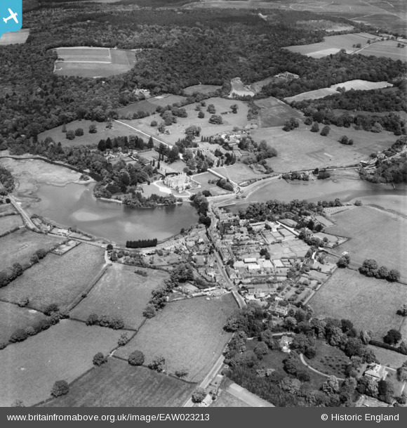
EAW023213 ENGLAND (1949). The village, Beaulieu, 1949
© Copyright OpenStreetMap contributors and licensed by the OpenStreetMap Foundation. 2025. Cartography is licensed as CC BY-SA.
Nearby Images (8)
Details
| Title | [EAW023213] The village, Beaulieu, 1949 |
| Reference | EAW023213 |
| Date | 19-May-1949 |
| Link | |
| Place name | BEAULIEU |
| Parish | BEAULIEU |
| District | |
| Country | ENGLAND |
| Easting / Northing | 438743, 102347 |
| Longitude / Latitude | -1.4499512450311, 50.818807832208 |
| National Grid Reference | SU387023 |
Pins

Matt Aldred edob.mattaldred.com |
Tuesday 9th of March 2021 02:01:07 PM | |

Matt Aldred edob.mattaldred.com |
Tuesday 9th of March 2021 02:00:19 PM | |

Class31 |
Sunday 19th of October 2014 08:17:31 PM | |

Class31 |
Sunday 19th of October 2014 08:16:34 PM | |

Class31 |
Sunday 19th of October 2014 08:16:01 PM | |

Class31 |
Sunday 19th of October 2014 08:14:20 PM | |

NewForestRemembers |
Wednesday 29th of January 2014 11:41:39 AM | |

NewForestRemembers |
Wednesday 29th of January 2014 11:40:03 AM |


![[EAW023213] The village, Beaulieu, 1949](http://britainfromabove.org.uk/sites/all/libraries/aerofilms-images/public/100x100/EAW/023/EAW023213.jpg)
![[EAW023214] The village, Beaulieu, 1949](http://britainfromabove.org.uk/sites/all/libraries/aerofilms-images/public/100x100/EAW/023/EAW023214.jpg)
![[EPW037450] The Mill Dam Pond, Palace House and the village, Beaulieu, from the south-west, 1932](http://britainfromabove.org.uk/sites/all/libraries/aerofilms-images/public/100x100/EPW/037/EPW037450.jpg)
![[EPW037451] Beaulieu Abbey, Beaulieu, 1932](http://britainfromabove.org.uk/sites/all/libraries/aerofilms-images/public/100x100/EPW/037/EPW037451.jpg)
![[EPW032278] Palace House, the ruins of Beaulieu Abbey and Great Goswell Copse, Beaulieu, from the south, 1930](http://britainfromabove.org.uk/sites/all/libraries/aerofilms-images/public/100x100/EPW/032/EPW032278.jpg)
![[EAW023216] Beaulieu Abbey, Beaulieu, 1949](http://britainfromabove.org.uk/sites/all/libraries/aerofilms-images/public/100x100/EAW/023/EAW023216.jpg)
![[EPW037449] Beaulieu Abbey, Beaulieu, from the south-east, 1932. This image has been produced from a print.](http://britainfromabove.org.uk/sites/all/libraries/aerofilms-images/public/100x100/EPW/037/EPW037449.jpg)
![[EAW023219] Beaulieu Abbey, Beaulieu, 1949](http://britainfromabove.org.uk/sites/all/libraries/aerofilms-images/public/100x100/EAW/023/EAW023219.jpg)

