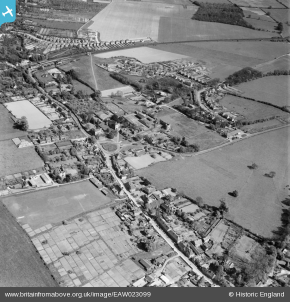
EAW023099 ENGLAND (1949). The village, Otford, 1949
© Copyright OpenStreetMap contributors and licensed by the OpenStreetMap Foundation. 2024. Cartography is licensed as CC BY-SA.
Nearby Images (6)
EAW023099

EPW032096

EAW023101

EPW032098

EPW032097

EAW023100

Details
| Title | [EAW023099] The village, Otford, 1949 |
| Reference | EAW023099 |
| Date | 10-May-1949 |
| Link | |
| Place name | OTFORD |
| Parish | OTFORD |
| District | |
| Country | ENGLAND |
| Easting / Northing | 552764, 159273 |
| Longitude / Latitude | 0.19210498221537, 51.311531498185 |
| National Grid Reference | TQ528593 |
Pins
 Susan F |
Monday 6th of October 2014 11:26:22 PM | |
Gone2Kent |
Sunday 20th of April 2014 04:25:42 PM | |
Gone2Kent |
Sunday 15th of December 2013 10:21:04 PM | |
Gone2Kent |
Sunday 15th of December 2013 10:19:32 PM | |
Gone2Kent |
Sunday 15th of December 2013 10:16:36 PM | |
Gone2Kent |
Sunday 15th of December 2013 10:14:09 PM | |
Gone2Kent |
Sunday 15th of December 2013 10:11:49 PM | |
Gone2Kent |
Sunday 15th of December 2013 10:10:41 PM |