
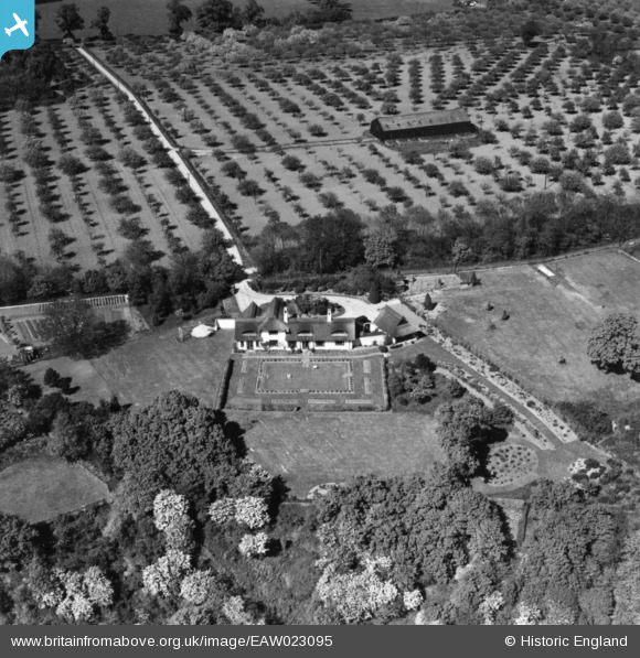
EAW023095 ENGLAND (1949). Highover, Hoo St Werburgh, 1949. This image has been produced from a print.
© Copyright OpenStreetMap contributors and licensed by the OpenStreetMap Foundation. 2026. Cartography is licensed as CC BY-SA.
Nearby Images (6)
EAW023095

EAW023096

EAW023097

EAW023098

EAW023081

EAW023087

Details
| Title | [EAW023095] Highover, Hoo St Werburgh, 1949. This image has been produced from a print. |
| Reference | EAW023095 |
| Date | 10-May-1949 |
| Link | |
| Place name | HOO ST WERBURGH |
| Parish | HOO ST. WERBURGH |
| District | |
| Country | ENGLAND |
| Easting / Northing | 576502, 171650 |
| Longitude / Latitude | 0.53854617734239, 51.415857739295 |
| National Grid Reference | TQ765717 |
Pins
Be the first to add a comment to this image!