
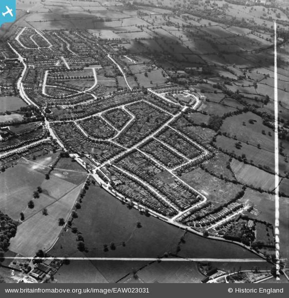
EAW023031 ENGLAND (1949). Housing estate, Potters Bar, 1949. This image has been produced from a print marked by Aerofilms Ltd for photo editing.
© Copyright OpenStreetMap contributors and licensed by the OpenStreetMap Foundation. 2026. Cartography is licensed as CC BY-SA.
Nearby Images (7)
EAW023031

EAW023036

EAW023032

EAW023037

EAW023033

EAW023030

EAW023034

Details
| Title | [EAW023031] Housing estate, Potters Bar, 1949. This image has been produced from a print marked by Aerofilms Ltd for photo editing. |
| Reference | EAW023031 |
| Date | 10-May-1949 |
| Link | |
| Place name | POTTERS BAR |
| Parish | |
| District | |
| Country | ENGLAND |
| Easting / Northing | 523907, 201466 |
| Longitude / Latitude | -0.20691348816847, 51.697784593435 |
| National Grid Reference | TL239015 |
Pins

SirTricky |
Saturday 5th of December 2015 06:39:09 AM | |
|
SirTricky |
Saturday 5th of December 2015 06:38:33 AM | |
|
SirTricky |
Saturday 5th of December 2015 06:37:47 AM | |
This is before the East Coast main line was enlarged from two to four lines in the mid-1950s, thereby needing a second tunnel parallel to this original one. |
John W |
Tuesday 6th of December 2016 05:23:04 PM |
|
SirTricky |
Saturday 5th of December 2015 06:33:36 AM | |
|
SirTricky |
Saturday 5th of December 2015 06:32:55 AM |