
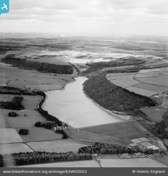
EAW023012 ENGLAND (1949). Tunstall Reservoir, Wolsingham, from the south, 1949
© Copyright OpenStreetMap contributors and licensed by the OpenStreetMap Foundation. 2026. Cartography is licensed as CC BY-SA.
Nearby Images (3)
EAW023012

EAW023011

EAW023010

Details
| Title | [EAW023012] Tunstall Reservoir, Wolsingham, from the south, 1949 |
| Reference | EAW023012 |
| Date | 9-May-1949 |
| Link | |
| Place name | WOLSINGHAM |
| Parish | WOLSINGHAM |
| District | |
| Country | ENGLAND |
| Easting / Northing | 406538, 540858 |
| Longitude / Latitude | -1.8983829111959, 54.762513925027 |
| National Grid Reference | NZ065409 |
Pins
Be the first to add a comment to this image!