
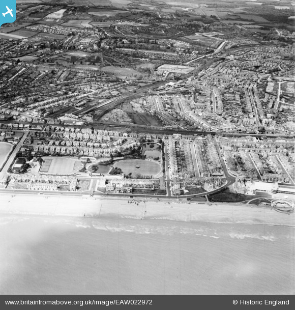
EAW022972 ENGLAND (1949). Egerton Park and the town, Bexhill, 1949
© Copyright OpenStreetMap contributors and licensed by the OpenStreetMap Foundation. 2026. Cartography is licensed as CC BY-SA.
Nearby Images (4)
EAW022972

EPW026225

EPW000123

EPW026221

Details
| Title | [EAW022972] Egerton Park and the town, Bexhill, 1949 |
| Reference | EAW022972 |
| Date | 6-May-1949 |
| Link | |
| Place name | BEXHILL |
| Parish | |
| District | |
| Country | ENGLAND |
| Easting / Northing | 573805, 107320 |
| Longitude / Latitude | 0.46876999365733, 50.838710462265 |
| National Grid Reference | TQ738073 |
Pins

John W |
Wednesday 26th of April 2023 09:43:26 AM | |
|
John W |
Wednesday 26th of April 2023 09:41:57 AM | |
|
John W |
Wednesday 26th of April 2023 09:38:04 AM | |
|
John W |
Saturday 11th of June 2016 05:41:57 PM | |
|
John W |
Saturday 11th of June 2016 05:32:55 PM | |
|
John W |
Saturday 11th of June 2016 05:31:31 PM |