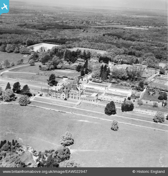
EAW022947 ENGLAND (1949). Worth Preparatory School, Turners Hill, from the south-east, 1949
© Copyright OpenStreetMap contributors and licensed by the OpenStreetMap Foundation. 2024. Cartography is licensed as CC BY-SA.
Details
| Title | [EAW022947] Worth Preparatory School, Turners Hill, from the south-east, 1949 |
| Reference | EAW022947 |
| Date | 6-May-1949 |
| Link | |
| Place name | TURNERS HILL |
| Parish | TURNERS HILL |
| District | |
| Country | ENGLAND |
| Easting / Northing | 531864, 134156 |
| Longitude / Latitude | -0.11684395724483, 51.091006216336 |
| National Grid Reference | TQ319342 |
Pins
 M Anton |
Tuesday 4th of June 2019 06:54:41 PM |


![[EAW022947] Worth Preparatory School, Turners Hill, from the south-east, 1949](http://britainfromabove.org.uk/sites/all/libraries/aerofilms-images/public/100x100/EAW/022/EAW022947.jpg)
![[EAW022950] Worth Preparatory School, Turners Hill, 1949](http://britainfromabove.org.uk/sites/all/libraries/aerofilms-images/public/100x100/EAW/022/EAW022950.jpg)
![[EAW022948] Worth Preparatory School, Turners Hill, 1949](http://britainfromabove.org.uk/sites/all/libraries/aerofilms-images/public/100x100/EAW/022/EAW022948.jpg)
![[EAW022949] Worth Preparatory School, Turners Hill, 1949](http://britainfromabove.org.uk/sites/all/libraries/aerofilms-images/public/100x100/EAW/022/EAW022949.jpg)