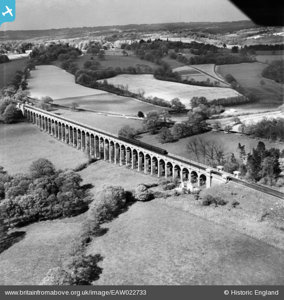
EAW022733 ENGLAND (1949). The Ouse Valley Viaduct, Brook Street, 1949
© Copyright OpenStreetMap contributors and licensed by the OpenStreetMap Foundation. 2026. Cartography is licensed as CC BY-SA.
Nearby Images (2)
EAW022733

EAW022734

Details
| Title | [EAW022733] The Ouse Valley Viaduct, Brook Street, 1949 |
| Reference | EAW022733 |
| Date | 29-April-1949 |
| Link | |
| Place name | BROOK STREET |
| Parish | ANSTY AND STAPLEFIELD |
| District | |
| Country | ENGLAND |
| Easting / Northing | 532344, 127808 |
| Longitude / Latitude | -0.11231574009561, 51.033837974577 |
| National Grid Reference | TQ323278 |
Pins

Adrian Backshall |
Friday 18th of December 2020 09:06:40 PM | |
|
M Anton |
Wednesday 18th of April 2018 08:17:51 AM | |
|
M Anton |
Wednesday 18th of April 2018 08:09:44 AM | |
|
John Wass |
Sunday 15th of March 2015 09:05:39 PM | |

bescotbeast |
Sunday 28th of September 2014 12:57:54 PM | |
|
Will Wallace |
Saturday 24th of May 2014 01:52:08 PM |