
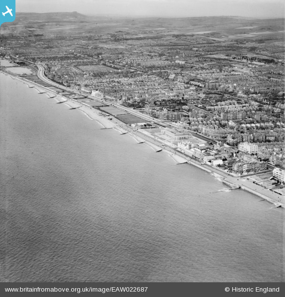
EAW022687 ENGLAND (1949). King's Esplanade, seafront and the town, Hove, from the south-east, 1949
© Copyright OpenStreetMap contributors and licensed by the OpenStreetMap Foundation. 2026. Cartography is licensed as CC BY-SA.
Nearby Images (6)
EAW022687

EPW000243

EPW045506

EPW012371

EPW054043

EPW000511

Details
| Title | [EAW022687] King's Esplanade, seafront and the town, Hove, from the south-east, 1949 |
| Reference | EAW022687 |
| Date | 25-April-1949 |
| Link | |
| Place name | HOVE |
| Parish | |
| District | |
| Country | ENGLAND |
| Easting / Northing | 528584, 104206 |
| Longitude / Latitude | -0.17424329822215, 50.8225381802 |
| National Grid Reference | TQ286042 |
