
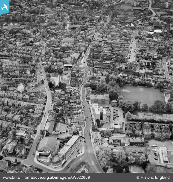
EAW022669 ENGLAND (1949). High Street and Sydenham Road, Guildford, 1949
© Copyright OpenStreetMap contributors and licensed by the OpenStreetMap Foundation. 2026. Cartography is licensed as CC BY-SA.
Nearby Images (9)
EAW022669

EAW014208

EPW022662

EAW014209

EAW015756

EPW009859

EPW054834

EPW054836

EPW054835

Details
| Title | [EAW022669] High Street and Sydenham Road, Guildford, 1949 |
| Reference | EAW022669 |
| Date | 25-April-1949 |
| Link | |
| Place name | GUILDFORD |
| Parish | |
| District | |
| Country | ENGLAND |
| Easting / Northing | 500014, 149609 |
| Longitude / Latitude | -0.56722096854125, 51.236372676998 |
| National Grid Reference | TQ000496 |
Pins

Stephen Godden |
Tuesday 21st of July 2026 04:00:48 PM | |

Sparky |
Sunday 27th of August 2017 07:07:47 AM | |
|
David960 |
Wednesday 11th of February 2015 07:11:19 PM | |
|
David960 |
Wednesday 11th of February 2015 07:08:44 PM | |
|
David960 |
Monday 2nd of February 2015 11:49:20 PM | |
|
David960 |
Monday 2nd of February 2015 11:47:18 PM | |
|
David960 |
Monday 2nd of February 2015 11:40:44 PM | |
|
David960 |
Monday 2nd of February 2015 11:37:39 PM | |
|
David960 |
Monday 2nd of February 2015 11:35:38 PM | |
|
David960 |
Monday 2nd of February 2015 11:34:51 PM | |
|
David960 |
Monday 2nd of February 2015 11:33:51 PM | |

Alan McFaden |
Friday 27th of December 2013 11:43:15 PM | |
|
Alan McFaden |
Friday 27th of December 2013 11:42:31 PM | |
|
Alan McFaden |
Friday 27th of December 2013 11:40:36 PM | |
|
Alan McFaden |
Friday 27th of December 2013 11:39:06 PM | |
|
Alan McFaden |
Friday 27th of December 2013 11:38:19 PM | |
|
percommode |
Friday 20th of December 2013 07:05:24 PM | |
|
percommode |
Friday 20th of December 2013 07:02:38 PM | |
|
percommode |
Friday 20th of December 2013 06:59:19 PM | |
|
percommode |
Friday 20th of December 2013 06:52:54 PM |


