
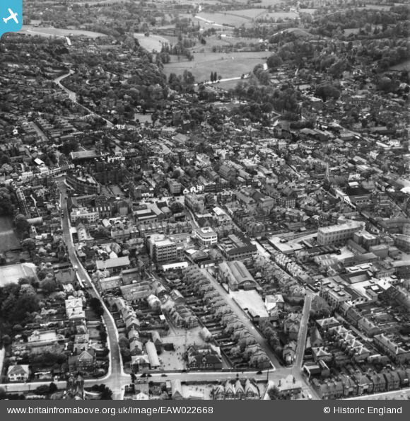
EAW022668 ENGLAND (1949). Sandfield Terrace and the town centre, Guildford, 1949. This image has been produced from a print.
© Copyright OpenStreetMap contributors and licensed by the OpenStreetMap Foundation. 2026. Cartography is licensed as CC BY-SA.
Nearby Images (18)
EAW022668

EAW014178

EAW014170

EAW014172

EAW014179

EAW014174

EAW014176

EPW016875

EAW014180

EAW014173

EAW014169

EAW014168

EAW014171

EPW022662

EPW054834

EPW054835

EPW054836

EPW009859

Details
| Title | [EAW022668] Sandfield Terrace and the town centre, Guildford, 1949. This image has been produced from a print. |
| Reference | EAW022668 |
| Date | 25-April-1949 |
| Link | |
| Place name | GUILDFORD |
| Parish | |
| District | |
| Country | ENGLAND |
| Easting / Northing | 499741, 149647 |
| Longitude / Latitude | -0.57112001699683, 51.23676210143 |
| National Grid Reference | SU997496 |
Pins

will |
Monday 22nd of July 2024 03:57:07 PM | |
|
will |
Monday 22nd of July 2024 03:28:28 PM | |
|
will |
Monday 22nd of July 2024 03:25:37 PM | |
|
will |
Monday 22nd of July 2024 03:22:01 PM | |

Class31 |
Thursday 26th of March 2015 12:30:34 PM | |
|
Class31 |
Thursday 26th of March 2015 12:29:20 PM | |
|
Class31 |
Thursday 26th of March 2015 12:28:26 PM | |
|
Class31 |
Thursday 26th of March 2015 12:27:42 PM | |
|
Class31 |
Thursday 26th of March 2015 12:24:54 PM |


