
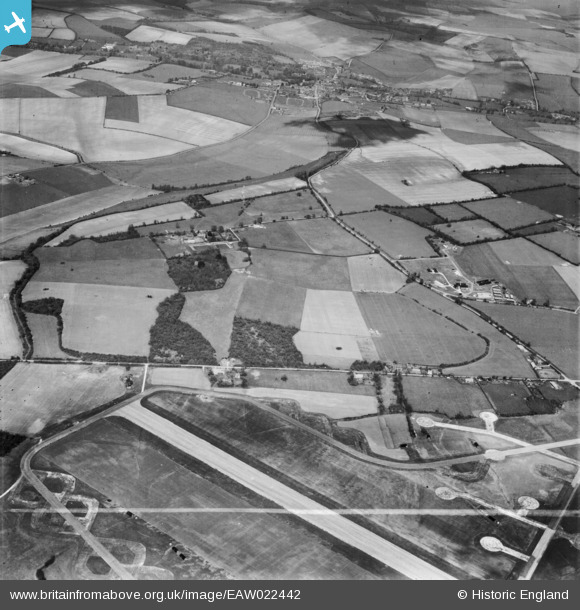
EAW022442 ENGLAND (1949). Membury Airfield and countryside around The Lambourn Stud (Kingwood Stud), Lambourn, 1949. This image was marked by Aerofilms Ltd for photo editing.
© Copyright OpenStreetMap contributors and licensed by the OpenStreetMap Foundation. 2026. Cartography is licensed as CC BY-SA.
Nearby Images (3)
EAW022442
, Lambourn, 1949. This image was marked by Aerofilms Ltd for photo editing.")
EAW022444
, Great West Wood and Little West Wood, Lambourn, 1949. This image was marked by Aerofilms Ltd for photo editing.")
EAW022441
, Lambourn, 1949. This image has been produced from a print marked by Aerofilms Ltd for photo editing.")
Details
| Title | [EAW022442] Membury Airfield and countryside around The Lambourn Stud (Kingwood Stud), Lambourn, 1949. This image was marked by Aerofilms Ltd for photo editing. |
| Reference | EAW022442 |
| Date | 22-April-1949 |
| Link | |
| Place name | LAMBOURN |
| Parish | LAMBOURN |
| District | |
| Country | ENGLAND |
| Easting / Northing | 430967, 176722 |
| Longitude / Latitude | -1.553943715627, 51.48811338056 |
| National Grid Reference | SU310767 |
