
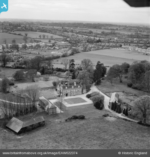
EAW022374 ENGLAND (1949). The Grove, Wheathampstead, from the north-east, 1949
© Copyright OpenStreetMap contributors and licensed by the OpenStreetMap Foundation. 2026. Cartography is licensed as CC BY-SA.
Nearby Images (3)
EAW022374

EAW022373

EAW022375

Details
| Title | [EAW022374] The Grove, Wheathampstead, from the north-east, 1949 |
| Reference | EAW022374 |
| Date | 19-April-1949 |
| Link | |
| Place name | WHEATHAMPSTEAD |
| Parish | WHEATHAMPSTEAD |
| District | |
| Country | ENGLAND |
| Easting / Northing | 515454, 213324 |
| Longitude / Latitude | -0.3252420199329, 51.806170516733 |
| National Grid Reference | TL155133 |
Pins
Be the first to add a comment to this image!