
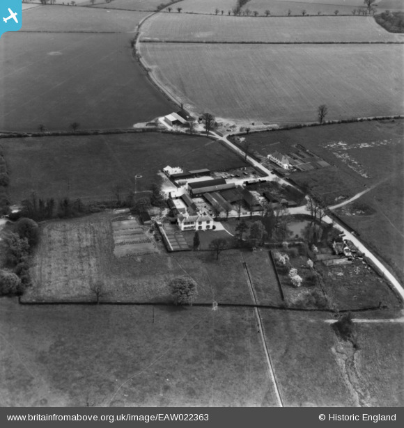
EAW022363 ENGLAND (1949). Patmore Hall, Patmore Heath, 1949
© Copyright OpenStreetMap contributors and licensed by the OpenStreetMap Foundation. 2026. Cartography is licensed as CC BY-SA.
Nearby Images (4)
EAW022363

EAW022361

EAW022362

EAW022364

Details
| Title | [EAW022363] Patmore Hall, Patmore Heath, 1949 |
| Reference | EAW022363 |
| Date | 19-April-1949 |
| Link | |
| Place name | PATMORE HEATH |
| Parish | ALBURY |
| District | |
| Country | ENGLAND |
| Easting / Northing | 545209, 225651 |
| Longitude / Latitude | 0.11127681975284, 51.910002833097 |
| National Grid Reference | TL452257 |
Pins

Matt Aldred edob.mattaldred.com |
Sunday 2nd of March 2025 03:17:33 PM |