
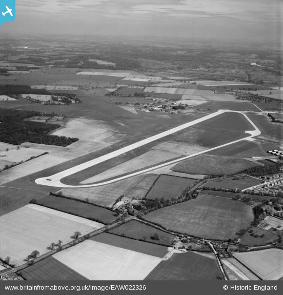
EAW022326 ENGLAND (1949). Hatfield Aerodrome, Hatfield, from the south, 1949
© Copyright OpenStreetMap contributors and licensed by the OpenStreetMap Foundation. 2026. Cartography is licensed as CC BY-SA.
Nearby Images (2)
EAW022326

EAW022327

Details
| Title | [EAW022326] Hatfield Aerodrome, Hatfield, from the south, 1949 |
| Reference | EAW022326 |
| Date | 19-April-1949 |
| Link | |
| Place name | HATFIELD |
| Parish | HATFIELD |
| District | |
| Country | ENGLAND |
| Easting / Northing | 520223, 208121 |
| Longitude / Latitude | -0.25790009561576, 51.758401106483 |
| National Grid Reference | TL202081 |
Pins

redmist |
Sunday 13th of March 2022 11:31:43 PM | |
|
redmist |
Sunday 13th of March 2022 11:31:02 PM | |
|
redmist |
Sunday 13th of March 2022 11:24:44 PM | |

Matt Aldred edob.mattaldred.com |
Wednesday 31st of March 2021 04:38:10 PM |