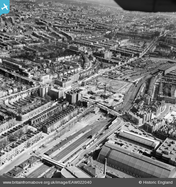
EAW022040 ENGLAND (1949). Charles House under construction, Warwick Road and environs, Kensington, from the north-west, 1949
© Copyright OpenStreetMap contributors and licensed by the OpenStreetMap Foundation. 2026. Cartography is licensed as CC BY-SA.
Nearby Images (27)
EAW022040

EPW010196

EAW022039
 Station, Olympia, 1949")
EAW022042
 Station, Olympia, 1949")
EAW004912

EPW025092
 station and environs, West Kensington, 1928")
EPW006523

EPW025090
 station and environs, West Kensington, 1928")
EAW022038
 Station, Olympia, 1949")
EPW045413

EPW006522

EPW010194

EPW010195

EAW009112

EPR000404

EPR000403

EPR000447

EAW022041
 Station, Olympia, 1949")
EPW025093
 station and environs, West Kensington, 1928")
EAW018714

EPW025089

EAW022043
 Station, Olympia, 1949")
EPW010179

EPW024267

EAW018713

EPR000448

EPW025091

Details
| Title | [EAW022040] Charles House under construction, Warwick Road and environs, Kensington, from the north-west, 1949 |
| Reference | EAW022040 |
| Date | 14-April-1949 |
| Link | |
| Place name | KENSINGTON |
| Parish | |
| District | |
| Country | ENGLAND |
| Easting / Northing | 524463, 179107 |
| Longitude / Latitude | -0.20680596272934, 51.496700419153 |
| National Grid Reference | TQ245791 |