
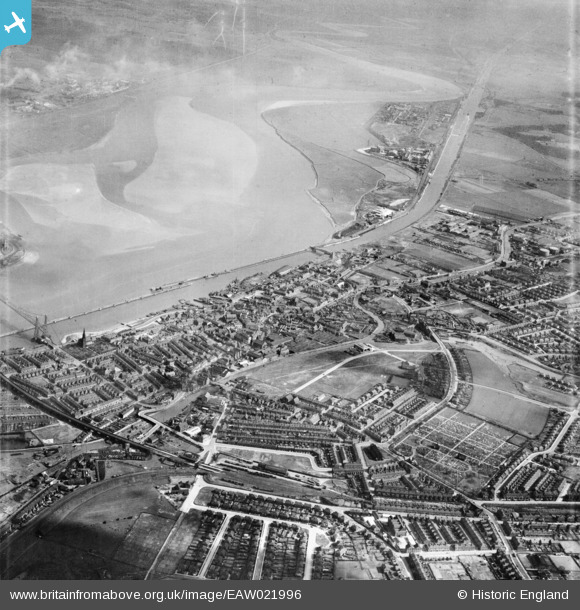
EAW021996 ENGLAND (1949). The town and Runcorn Sands, Runcorn, 1949
© Copyright OpenStreetMap contributors and licensed by the OpenStreetMap Foundation. 2026. Cartography is licensed as CC BY-SA.
Nearby Images (3)
EAW021996

EPW018919

EPW021651

Details
| Title | [EAW021996] The town and Runcorn Sands, Runcorn, 1949 |
| Reference | EAW021996 |
| Date | 9-April-1949 |
| Link | |
| Place name | RUNCORN |
| Parish | |
| District | |
| Country | ENGLAND |
| Easting / Northing | 351673, 383122 |
| Longitude / Latitude | -2.7259452442725, 53.342517869314 |
| National Grid Reference | SJ517831 |
Pins

Bottom Yard |
Sunday 15th of June 2025 12:46:16 PM | |
|
Bottom Yard |
Sunday 15th of June 2025 12:37:53 PM | |
|
Bottom Yard |
Sunday 15th of June 2025 12:36:24 PM | |
|
Bottom Yard |
Sunday 15th of June 2025 12:31:09 PM | |
|
Bottom Yard |
Wednesday 7th of September 2022 03:53:33 PM | |

Ginger79 |
Wednesday 3rd of March 2021 09:18:25 PM | |
|
Ginger79 |
Wednesday 3rd of March 2021 09:10:18 PM | |
|
Ginger79 |
Wednesday 3rd of March 2021 09:09:37 PM | |
|
Ginger79 |
Sunday 7th of June 2020 06:40:19 AM |