
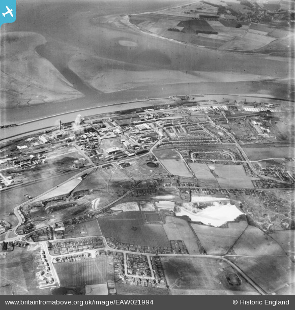
EAW021994 ENGLAND (1949). Weston Point, Runcorn, 1949
© Copyright OpenStreetMap contributors and licensed by the OpenStreetMap Foundation. 2026. Cartography is licensed as CC BY-SA.
Nearby Images (4)
EAW021994

EAW021992

EAW021991

EAW023476

Details
| Title | [EAW021994] Weston Point, Runcorn, 1949 |
| Reference | EAW021994 |
| Date | 9-April-1949 |
| Link | |
| Place name | RUNCORN |
| Parish | |
| District | |
| Country | ENGLAND |
| Easting / Northing | 350100, 380969 |
| Longitude / Latitude | -2.7492327085293, 53.323018606822 |
| National Grid Reference | SJ501810 |
Pins

Bottom Yard |
Sunday 15th of June 2025 12:27:07 PM | |
|
Bottom Yard |
Sunday 15th of June 2025 12:25:55 PM | |
|
Bottom Yard |
Sunday 15th of June 2025 12:24:15 PM | |
|
Bottom Yard |
Sunday 15th of June 2025 12:22:51 PM | |
|
HAP_Weston |
Friday 6th of June 2025 05:30:27 PM | |
|
HAP_Weston |
Friday 6th of June 2025 05:18:57 PM | |
|
HAP_Weston |
Friday 6th of June 2025 05:16:23 PM | |
|
HAP_Weston |
Friday 6th of June 2025 05:15:53 PM | |
|
HAP_Weston |
Friday 6th of June 2025 05:15:28 PM | |
|
HAP_Weston |
Friday 6th of June 2025 05:14:57 PM | |
|
HAP_Weston |
Friday 6th of June 2025 05:14:21 PM | |
|
HAP_Weston |
Friday 6th of June 2025 05:13:58 PM | |
|
HAP_Weston |
Friday 6th of June 2025 05:13:32 PM | |
|
HAP_Weston |
Friday 6th of June 2025 05:12:58 PM | |
|
HAP_Weston |
Friday 6th of June 2025 05:12:38 PM | |
|
HAP_Weston |
Friday 6th of June 2025 05:09:15 PM | |
|
HAP_Weston |
Friday 6th of June 2025 05:06:43 PM | |
|
HAP_Weston |
Friday 6th of June 2025 05:04:32 PM | |
|
HAP_Weston |
Friday 6th of June 2025 05:03:13 PM | |
|
HAP_Weston |
Friday 6th of June 2025 05:01:53 PM | |
|
HAP_Weston |
Friday 6th of June 2025 05:00:43 PM | |
|
HAP_Weston |
Friday 6th of June 2025 05:00:13 PM | |
|
HAP_Weston |
Friday 6th of June 2025 04:59:01 PM | |
|
HAP_Weston |
Friday 6th of June 2025 04:58:22 PM | |
|
HAP_Weston |
Friday 6th of June 2025 04:58:00 PM | |
|
HAP_Weston |
Friday 6th of June 2025 04:57:36 PM | |
|
HAP_Weston |
Friday 6th of June 2025 04:57:04 PM | |
|
HAP_Weston |
Friday 6th of June 2025 04:56:06 PM | |
|
HAP_Weston |
Friday 6th of June 2025 04:55:53 PM | |
|
HAP_Weston |
Friday 6th of June 2025 04:55:35 PM | |
|
HAP_Weston |
Friday 6th of June 2025 04:54:43 PM | |
|
HAP_Weston |
Friday 6th of June 2025 04:54:25 PM | |
|
HAP_Weston |
Friday 6th of June 2025 04:53:39 PM | |
|
HAP_Weston |
Friday 6th of June 2025 04:53:11 PM | |
|
HAP_Weston |
Friday 6th of June 2025 04:52:44 PM | |
|
HAP_Weston |
Friday 6th of June 2025 04:52:13 PM | |
|
HAP_Weston |
Friday 6th of June 2025 04:51:48 PM | |
|
HAP_Weston |
Friday 6th of June 2025 04:51:34 PM | |
|
HAP_Weston |
Friday 6th of June 2025 04:50:58 PM | |
|
HAP_Weston |
Friday 6th of June 2025 04:50:26 PM | |
|
HAP_Weston |
Friday 6th of June 2025 04:50:02 PM | |
|
HAP_Weston |
Friday 6th of June 2025 04:49:08 PM | |
|
HAP_Weston |
Friday 6th of June 2025 04:48:53 PM | |
|
HAP_Weston |
Friday 6th of June 2025 04:48:28 PM | |
|
HAP_Weston |
Friday 6th of June 2025 04:48:11 PM | |
|
HAP_Weston |
Friday 6th of June 2025 04:47:51 PM | |
|
HAP_Weston |
Friday 6th of June 2025 04:47:34 PM | |
|
HAP_Weston |
Friday 6th of June 2025 04:47:07 PM | |
|
HAP_Weston |
Friday 6th of June 2025 04:46:53 PM | |
|
HAP_Weston |
Friday 6th of June 2025 04:46:31 PM | |
|
HAP_Weston |
Friday 6th of June 2025 04:45:11 PM | |
|
HAP_Weston |
Friday 6th of June 2025 04:44:28 PM | |
|
HAP_Weston |
Friday 6th of June 2025 04:43:51 PM | |
|
Bottom Yard |
Friday 27th of December 2024 06:06:23 PM | |
|
Bottom Yard |
Friday 27th of December 2024 06:05:49 PM | |
|
Bottom Yard |
Friday 27th of December 2024 06:05:07 PM | |
|
Bottom Yard |
Friday 27th of December 2024 06:03:48 PM | |
|
Bottom Yard |
Friday 27th of December 2024 06:02:04 PM | |
|
Bottom Yard |
Friday 27th of December 2024 06:00:58 PM | |

Ginger79 |
Wednesday 3rd of March 2021 09:04:55 PM | |
|
Rhoobarb |
Saturday 14th of June 2014 11:46:43 AM |