
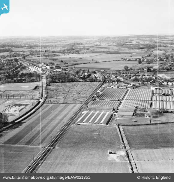
EAW021851 ENGLAND (1949). The Sprat and Winkle Railway Line and Tadburn Nursery, Romsey, from the south-east, 1949. This image was marked by Aerofilms Ltd for photo editing.
© Copyright OpenStreetMap contributors and licensed by the OpenStreetMap Foundation. 2026. Cartography is licensed as CC BY-SA.
Nearby Images (15)
EAW021851

EAW021855

EAW021853

EAW022432

EAW021854

EAW022435

EAW022434

EAW022438

EAW022436

EAW022439

EAW022433

EAW022440

EAW022437

EAW021852

EAW021850

Details
| Title | [EAW021851] The Sprat and Winkle Railway Line and Tadburn Nursery, Romsey, from the south-east, 1949. This image was marked by Aerofilms Ltd for photo editing. |
| Reference | EAW021851 |
| Date | 9-April-1949 |
| Link | |
| Place name | ROMSEY |
| Parish | ROMSEY |
| District | |
| Country | ENGLAND |
| Easting / Northing | 436239, 120734 |
| Longitude / Latitude | -1.4836742524615, 50.984325471559 |
| National Grid Reference | SU362207 |
Pins

redmist |
Friday 23rd of December 2022 03:38:55 PM |