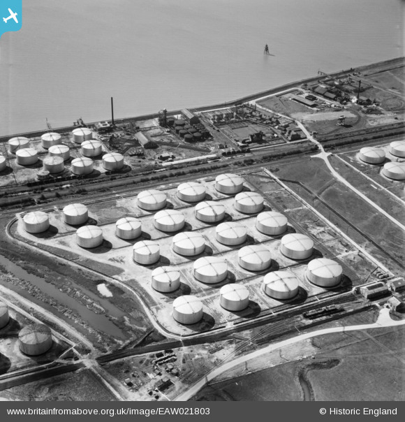
EAW021803 ENGLAND (1949). The Shell Haven Oil Refinery, Thames Haven, 1949
© Copyright OpenStreetMap contributors and licensed by the OpenStreetMap Foundation. 2026. Cartography is licensed as CC BY-SA.
Nearby Images (5)
Details
| Title | [EAW021803] The Shell Haven Oil Refinery, Thames Haven, 1949 |
| Reference | EAW021803 |
| Date | 9-April-1949 |
| Link | |
| Place name | THAMES HAVEN |
| Parish | |
| District | |
| Country | ENGLAND |
| Easting / Northing | 572615, 181753 |
| Longitude / Latitude | 0.48763129182666, 51.507820997683 |
| National Grid Reference | TQ726818 |
Pins

cptpies |
Wednesday 29th of April 2020 01:41:29 PM |


![[EAW021803] The Shell Haven Oil Refinery, Thames Haven, 1949](http://britainfromabove.org.uk/sites/all/libraries/aerofilms-images/public/100x100/EAW/021/EAW021803.jpg)
![[EAW034224] The Shell Haven Oil Refinery, Corringham, 1950](http://britainfromabove.org.uk/sites/all/libraries/aerofilms-images/public/100x100/EAW/034/EAW034224.jpg)
![[EPW032108] Shell Haven Oil Refinery, Corringham, 1930](http://britainfromabove.org.uk/sites/all/libraries/aerofilms-images/public/100x100/EPW/032/EPW032108.jpg)
![[EAW003533] Oil Storage Tanks at Coryton Oil Refinery, Coryton, 1947](http://britainfromabove.org.uk/sites/all/libraries/aerofilms-images/public/100x100/EAW/003/EAW003533.jpg)
![[EAW027728] Construction work at the Shell Haven Oil Refinery, Corringham, 1949](http://britainfromabove.org.uk/sites/all/libraries/aerofilms-images/public/100x100/EAW/027/EAW027728.jpg)