
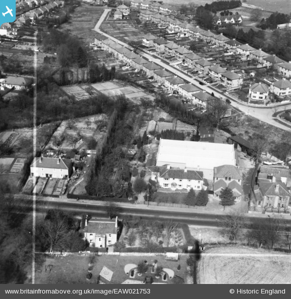
EAW021753 ENGLAND (1949). Cedars Laundry, Farnborough, 1949. This image has been produced from a print marked by Aerofilms Ltd for photo editing.
© Copyright OpenStreetMap contributors and licensed by the OpenStreetMap Foundation. 2026. Cartography is licensed as CC BY-SA.
Nearby Images (9)
EAW021753

EAW021748
, Farnborough, 1949. This image has been produced from a damaged negative.")
EAW021750

EAW021647

EAW021754

EAW021747

EAW021749

EAW021751

EAW021752

Details
| Title | [EAW021753] Cedars Laundry, Farnborough, 1949. This image has been produced from a print marked by Aerofilms Ltd for photo editing. |
| Reference | EAW021753 |
| Date | 1-April-1949 |
| Link | |
| Place name | FARNBOROUGH |
| Parish | |
| District | |
| Country | ENGLAND |
| Easting / Northing | 543633, 164571 |
| Longitude / Latitude | 0.063309813229302, 51.361522696026 |
| National Grid Reference | TQ436646 |
Pins
Be the first to add a comment to this image!